
Battlefield Maps - War at Sea
 This section of the website reproduces large-scale maps categorised by battlefront covering the key battles and offensives fought from 1914-18.
Specifically, this page contains maps illustrating the course of the naval war fought at sea.
The sidebar to the right lists each map category available within the section. Click here to view an introduction to the map series.
Three versions of each map are available - standard, large and very large. Generally standard files possess a resolution of 800x600 (approx. 70KB); large files 1600x1200 (approx. 140KB) and very large files 4000x3000 (approx. 550KB).
| Map Name | Description | Standard | Large | Very Large |
|---|---|---|---|---|
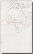
| Naval Operations in 1914 | British and German operations |
|
|
|
| Battle of Jutland | Movements on 30-31 May 1916 |
|
|
|
Click here to view a collection of maps produced within various publications while the war was still underway.
Flak was a term used to describe anti-aircraft fire.
- Did you know?